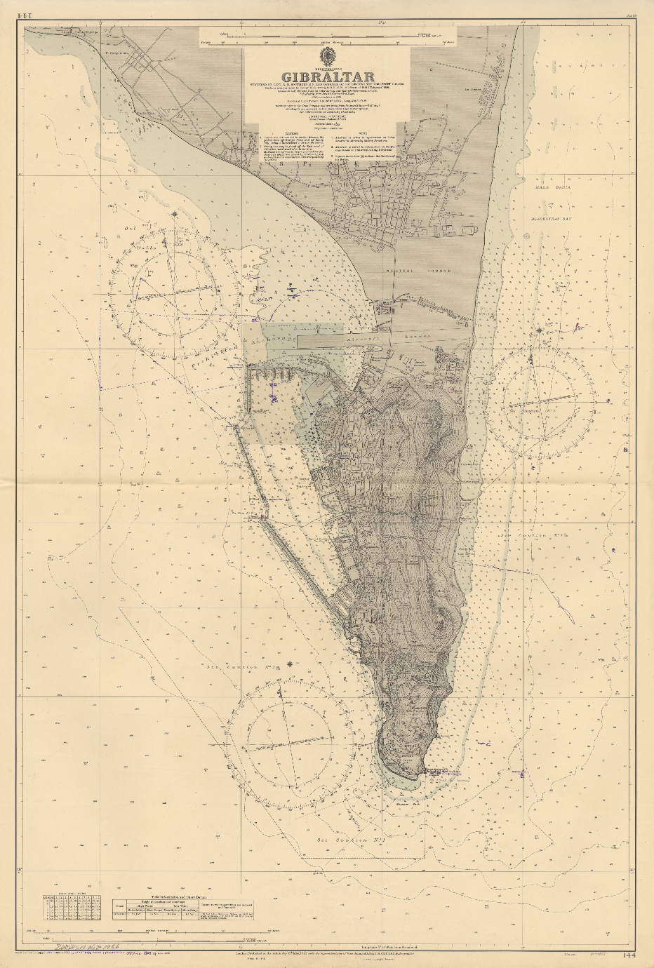
Part of the digital library maintained by the Universidade de Coimbra, the Mapas Nabais Conde collection houses a treasure trove of country-themed background notes published by the U.S. Department of State in the 1970s, official government cartography from Portugal just after the Carnation Revolution, & UK gems like this 1953 map of Gibraltar.
So much has changed in Gibraltar! If I’d known as a kid that the profession of hydrographer was a real thing, Vice-Admiral Sir Archibald Day, KBE, CB, DSO would have certainly been my role model. The detail is stunning, & I’m surprised to find a tuna factory on the map. Well, actually more surprised that it’s not there today.